(Posted from Normanton in the Gulf … only a few more blogs to catch up on).
Sometimes the places we are ambivalent about visiting turn out to be some of the best, or at least they have a few special places-within-the-main-place. And so it was with Mt. Isa.
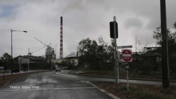
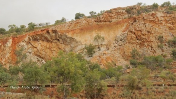
Like Broken Hill, Mt. Isa is a mining town started in the 1920s and dominated by one or more representatives of the mining industry, in this case a couple of huge smoke stacks and mining structures. Unlike Broken Hill however it has a plentiful supply of water unlikely to become depleted in the near future. The main streets are lined with trees and private homes have flower gardens. There is a modern shopping centre. Huge road trains thunder along the highway.


We set up in a camp just outside the town, on the road to Lake Moondarra. Unlike most other camps this one had rows and rows of single-room cabins each with an air conditioning unit and also many static caravans with annexes, obviously semi-permanent homes. I guess this reflects on the transient population.
The weather was not too good but little further rain was expected so we felt safe in the camp, accessed via a floodway.
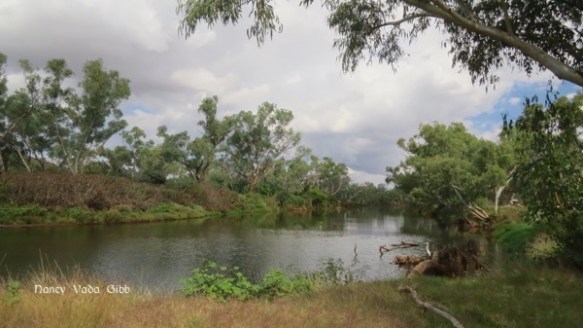
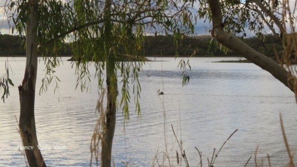
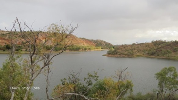
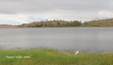
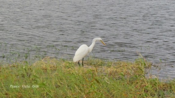
We paid a visit to the Lake, not knowing what to expect. Certainly not such a huge expanse of water!
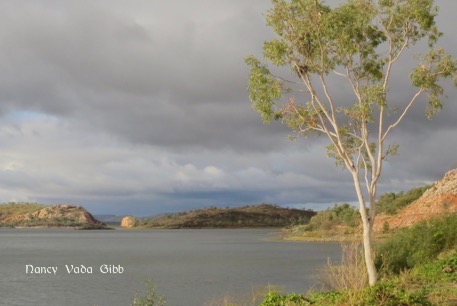
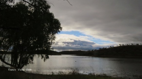
It started with a dam over the Leichhardt River constructed by Mt. Isa Mines – at the time it was Australia’s largest privately funded water scheme. Before then Mt. Isa’s water needs were met by a series of bores, which ironically is the situation now facing Broken Hill as the Menindee Lakes are practically dry due to the Murray no longer flowing. (The dam is just visible on the far right in the photo below).
“In late 1956 a rocky gorge on the Leichhardt River 16 km downstream from the township was selected due to its natural bedrock attributes …. work began without delay …. seasonal rains in December 1956 sent flood waters rushing through the gorge causing extensive damage to the partially completed wall … it was finally finished in 1957.”
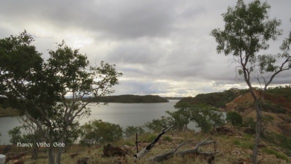
For those who want to know, the catchment area is 111,369 hectares, dam surface area about 2.6 hectares, storage capacity/volume 107 gigalitres and max depth 11 metres.
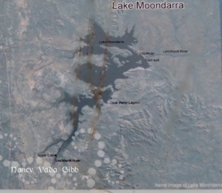
The names Lake Moondarra and Warrina Park (below the dam) were selected from over 400 entries by local school children.
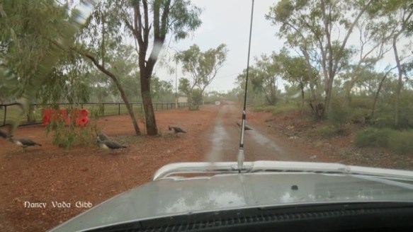
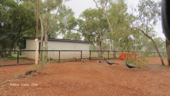
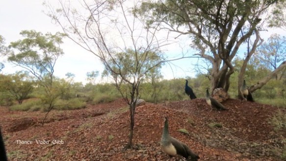
We had a quick look around Warrina Park, it would be lovely on a fine day but not in the rain. Along the perimeter we came to a sudden halt at a peacock crossing … so many birds! They must be a great attraction.
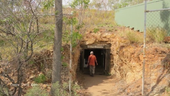
We did not ‘do’ the celebrated Mt. Isa Hard Times Mine, “an unique underground experience”, but we did visit the Underground Hospital. Another item on my Must-See list. Run by a couple of hard-working local volunteers, who offered us a cup of tea with them on closing as we were the last two visitors and had asked lots of questions. I was delighted to find some information about old families pertinent to my family history in some old books on display. (They’ll be included in a future blog in the Darchy Chronicles).
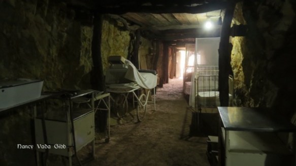
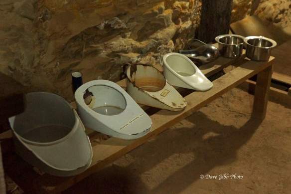
Besides the underground section there was a treasure-trove of medical and surgical items in the old house which served as an entrance. (It was part of the old hospital itself). Even on the verandahs……


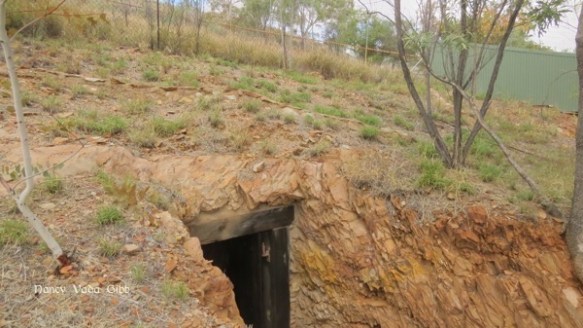
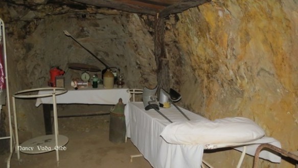
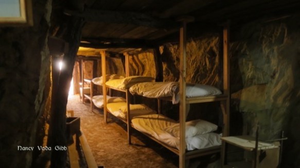
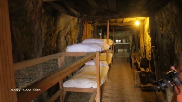
The Underground Hospital was constructed by volunteer Mt. Isa Mine workers in the hill beside the existing hospital in 1942, when Northern Australia was on a war footing. Darwin had been bombed earlier that year and it was feared Mt. Isa would be next.
The Underground Hospital was completed quickly, an E-shaped structure carved out of the hill with surgical, medical and maternity facilities, and even and outpatients department and operating theatres. Fortunately it never had to be used for the purpose for which it had been built. In later years some nurses on night shift used it as a cool and quiet place to sleep!

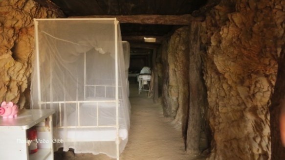
It fell into disuse and was forgotten then rediscovered in 1977 …. the roof was partially collapsed, debris everywhere, and wooden fittings white-ant eaten. In 1997 restoration started using old photographs as there were no plans or details on record.
Bunk beds constructed according to the old photos
A storage cupboard constructed from old packing cases, just as in the old photos.
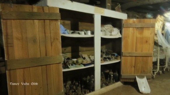
Some of the artefacts recovered from the rubble.

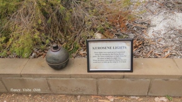
There were various interesting signs and some objects along the short walk to the underground hospital. Such as a number of these kerosene lights used to mark out the Camooweal airstrip for the Flying Doctor plane.
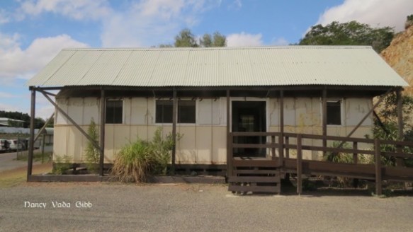
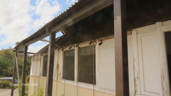
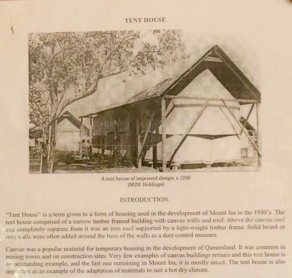
One more thing – right next to the hospital is an example of a ‘Tent House’, the last one remaining. With canvas walls, roof and sunshades, protected by a completely separate corrugated-iron second roof.
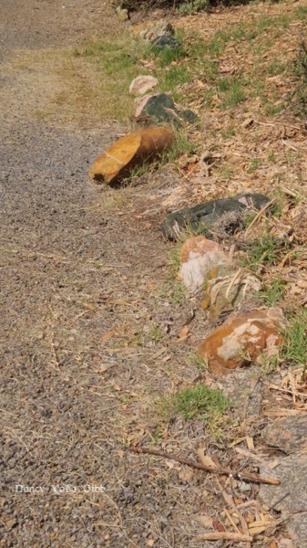
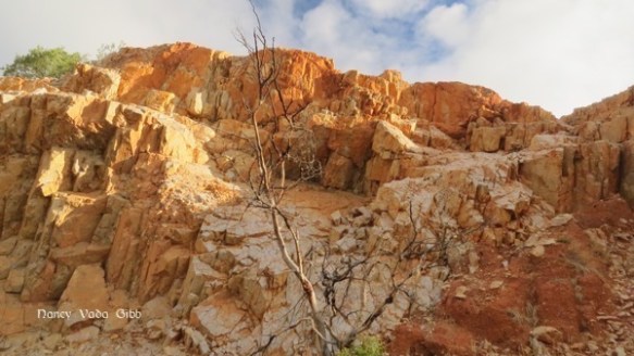
No, two more things. Lining the parking ground to the Underground Hospital and Tent House are fantastic examples of mineral-bearing rocks. I could not believe they were just casually sitting there. Usually such things are only seen in museums. But it was Mt. Isa!